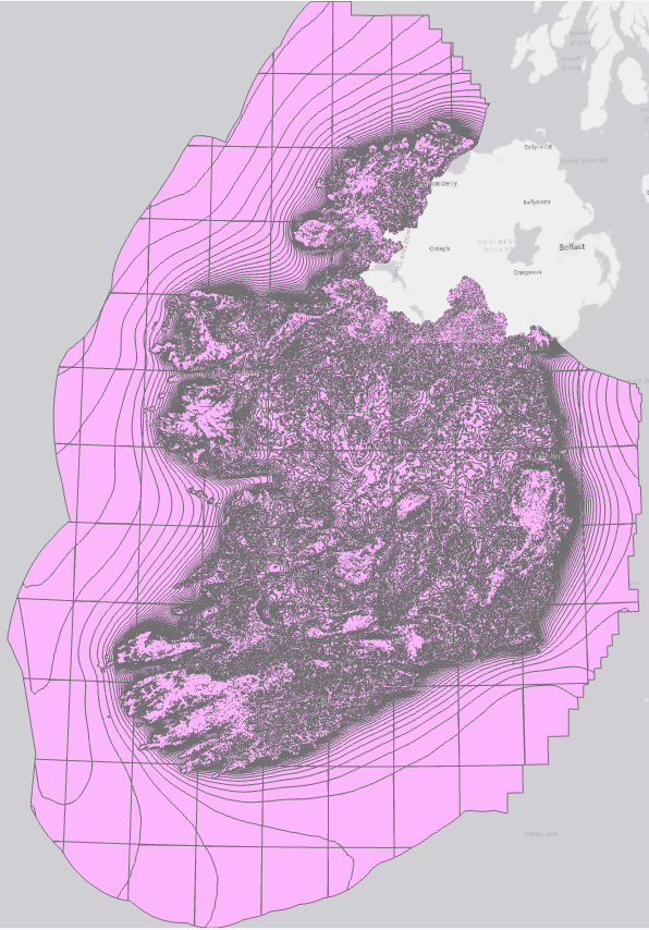
average-wind-speeds-2001-to-2010-50m-above-ground-level
Resource: Wind speed 50m in ITM
URL https://seaiopendata.blob.core.windows.net/wind/WindSpeed_50m_ITM.zip
Additional Information
| Field | Value |
|---|---|
| Data last updated | 23 Iúil 2021 |
| Metadata last updated | 14 Bealtaine 2025 |
| Created | 23 Iúil 2021 |
| Formáid | SHP |
| Ceadúna | Creative Commons Attribution 4.0 |
| Access url | https://seaiopendata.blob.core.windows.net/wind/WindSpeed_50m_ITM.zip |
| Download url | https://seaiopendata.blob.core.windows.net/wind/WindSpeed_50m_ITM.zip |
| Has views | True |
| Id | 7295e20d-d020-4974-88d6-cfc6391d5b2d |
| Mimetype | application/zip |
| Notes | Dataset of average wind speed at 50m above ground level in Irish Transverse Mercator (ITM) spatial reference system. Source: SEAI Wind Atlas (http://gis.seai.ie/wind). |
| Package id | fb9049b7-b74f-479f-9bb7-d27d67c5e65d |
| State | active |
| Superset Dataset | |
| Cur síos | Dataset of average wind speed at 50m above ground level in Irish Transverse Mercator (ITM) spatial reference system. Source: SEAI Wind Atlas (http://gis.seai.ie/wind). |
| High Value Dataset (HVD) Resource | Níl |
| Reachtaiocht Infheidhme | |
| Formáidí freagartha API | |
| Cineál API | |
| Url Rochtana API |
 Derilinx