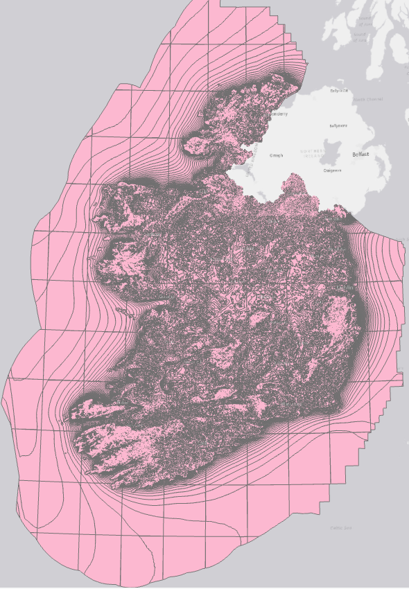
average-wind-speeds-2001-to-2010-40m-above-ground-level
Resource: Wind speed 40m in WGS 84 (EPSG:3857)
URL https://seaiopendata.blob.core.windows.net/wind/WindSpeed_40m_EPSG3857.zip
Additional Information
| Field | Value |
|---|---|
| Data last updated | 23 Iúil 2021 |
| Metadata last updated | 14 Bealtaine 2025 |
| Created | 23 Iúil 2021 |
| Formáid | SHP |
| Ceadúna | Creative Commons Attribution 4.0 |
| Access url | https://seaiopendata.blob.core.windows.net/wind/WindSpeed_40m_EPSG3857.zip |
| Download url | https://seaiopendata.blob.core.windows.net/wind/WindSpeed_40m_EPSG3857.zip |
| Has views | True |
| Id | c79fef05-0bda-43c3-807e-8c80a4e16fe3 |
| Mimetype | application/zip |
| Notes | Dataset of average wind speed at 40m above ground level in WGS 84 Web Mercator (EPSG:3857) spatial reference system. Source: SEAI Wind Atlas (http://gis.seai.ie/wind). |
| Package id | b0515bf6-6836-4368-86a1-60f7f73f6202 |
| Position | 1 |
| State | active |
| Superset Dataset | |
| Cur síos | Dataset of average wind speed at 40m above ground level in WGS 84 Web Mercator (EPSG:3857) spatial reference system. Source: SEAI Wind Atlas (http://gis.seai.ie/wind). |
| High Value Dataset (HVD) Resource | Níl |
| Applicable Legislation | |
| Formáidí freagartha API | |
| Cineál API | |
| Url Rochtana API |
 Derilinx